 |
|
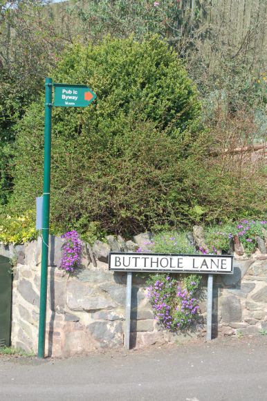
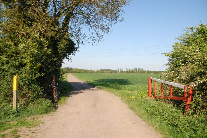
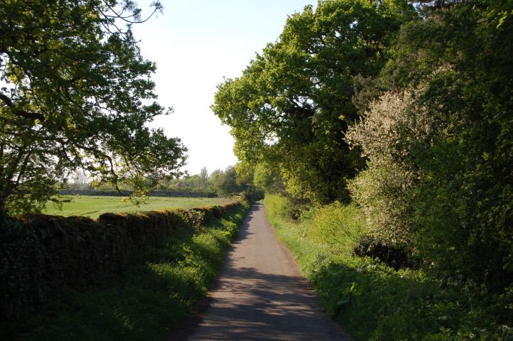
A view looking up the
Shepshed end of Butthole lane. It was given a tarmac surface at the
start of 2000. Prior to that it was a rough surface akin to
granite cobbles but with the sets laid with corner up and hence gave a
rough ride.
©2008 Stephen Dee
ID 2008-05-08-27361 |
 |
|
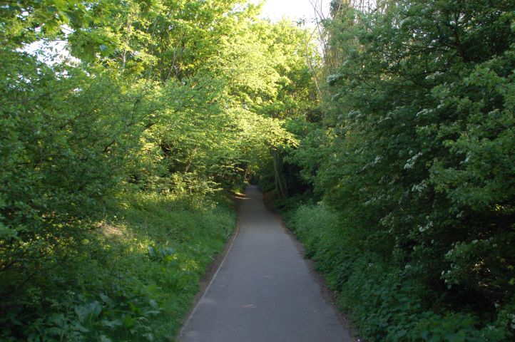
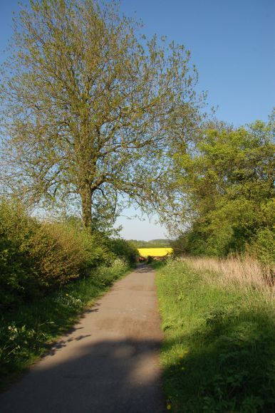
Butthole Lane by the bottom
end of the allotments in Shepshed, Butthole Lane gets a lot of traffic
from allotment holders who drive rather then walk to their plots.
©2008 Stephen Dee
ID 2008-05-08-27353 |
 |
|
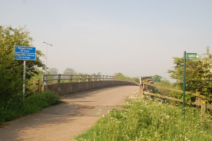
After passing the Allotments and the Playing
fields for the two Shepshed Schools, the M1 is crossed. The bridge
has a restriction which is ignored by all cyclists! Clue - it is
not the weight restriction.
©2008 Stephen Dee
ID 2008-05-11-27518 |
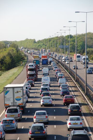 |
A frequent view when crossing the M1, especially
in the afternoons when northbound traffic can be crawling or stationary.
About twice a year at least the M1 gets closed due to bad driving and
traffic chaos results on the local roads.
©2008 Stephen Dee
ID 2008-05-08-27345 (L)
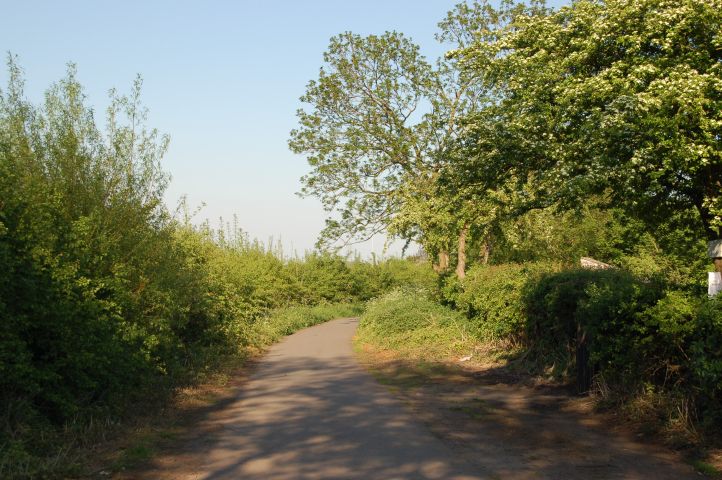
Looking down byway L17/Butthole Lane after the
descent from the motorway bridge.
©2008 Stephen Dee
ID 2008-05-08-27334 (R) |
 |
 |
|
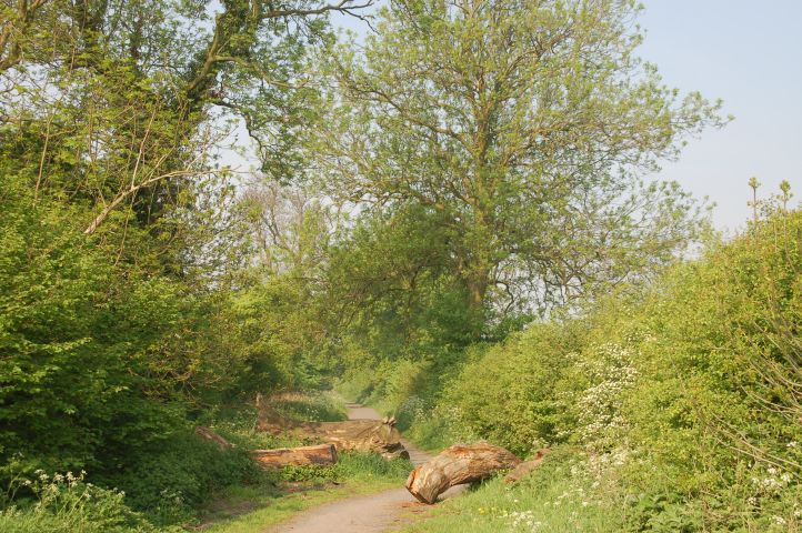
About 1.1 mile from home, the
landlord has placed logs across the route to prevent cars being dumped
on the estate. Butthole Lane is shown as a road on GPS mapping, and on one
occasion on the way to work when the M1 was in chaos I found an idiot
car driver trying to save time trying get past. If he did he would
of of come across locked gates at the Loughborough end not to mention an
abrupt mismatch between what his GPS would of told him to do and
the reality at the end of byway L17.
©2008 Stephen Dee
ID 2008-05-11-27521 |
 |
|
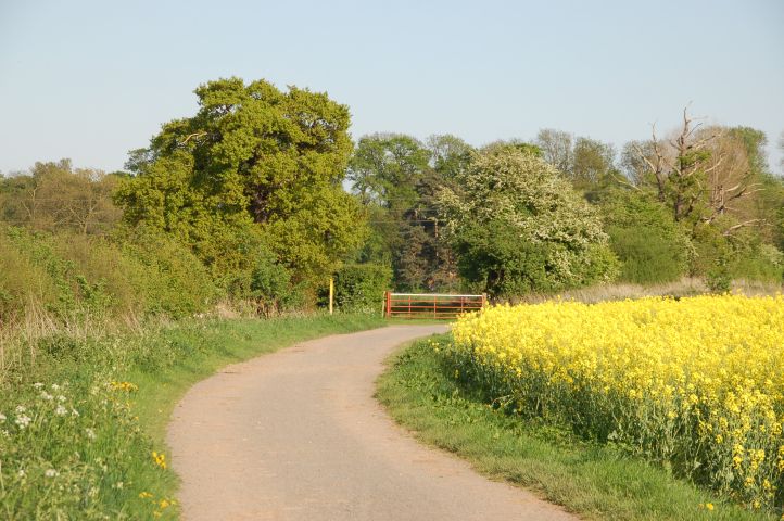
The yellow footpath marker
marks the end of byway L17. To the right behind the trees is
footpath K68 which has been a permissive cycle route since 1978 I
believe. The gate is where Butthole Lane continues, but it is not
defined through the field and is not a right of way. The GPS
systems and Google Maps shows Butthole Lane continuing, but the estate road which K68
follows as a road that ends in the middle of nowhere. Mapping
systems such as Multimap.com show the same error, look up the location
SK493201.
©2008 Stephen Dee
ID 2008-05-08-27330 |
 |
|
A short way down K68, there
is gate that can be locked shut on many occasions. This is not a
problem and is legal as the route is a permissive cycle route along the
footpath of K68. When locked there is a gap to the left of my bike
in which is possible to ride a solo but walk a triplet and trailer through.
©2008 Stephen Dee
ID 2008-05-08-27323 |
 |
|
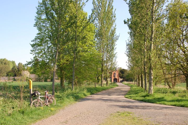
The estate road which K68
follows joins up with Hathern Drive, an estate road that starts at the
south end of Hathern and leads in an almost straight line to the gateway
at the end of an avenue of popular trees.
©2008 Stephen Dee
ID 2008-05-08-27320 |
 |
|
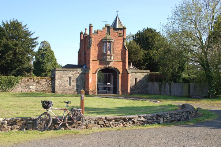
The nice brick gateway as a
main entrance to the estate buildings and house. In front of the
gateway there is a raised grassed bed which forms a large roundabout.
It is used by the local kids as a velodrome.
©2008 Stephen Dee
ID 2008-05-08-27314 |
 |
|
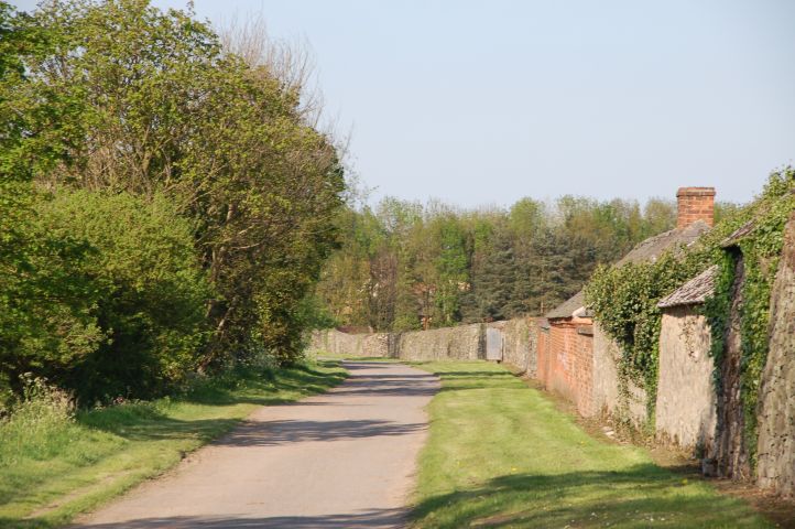
After the gateway the estate
road follows the walls of the estate yard. In the winter months
when they have worked on the fields the tracks can be very dirty.
Most of the dirt picked up by my bike comes from riding to work across
the Garendon estate. I punctured along this stretch at 0:30am on
the way home from a boys night out!
©2008 Stephen Dee
ID 2008-05-08-27316 |
 |
|
This is the estate road at
the back end of Loughborough, behind the trees on right are the newer
housing estates of the Thorpe Acre area of Loughborough.
©2008 Stephen Dee
ID 2008-05-08-27309 |
 |
|
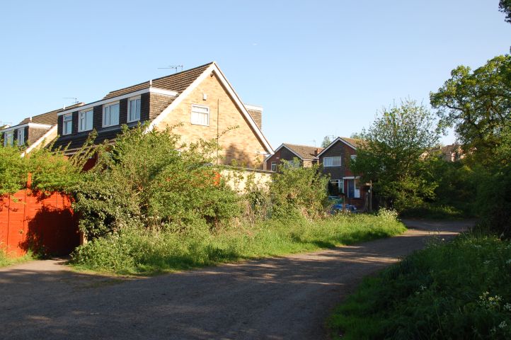
The end of the ride across
the Garendon estate. The cycle route goes through the gape between
the fence and the bushes, whereas the estate access is through gates
into Coe Ave, a bit further to the right. This ends a 2 mile stint
of "off road".
©2008 Stephen Dee
ID 2008-05-08-27302 |
|
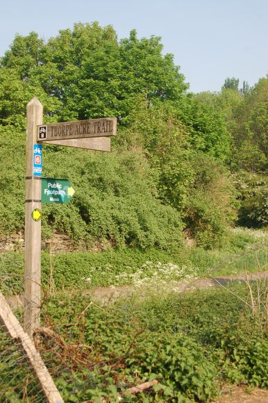
The footpath sign post at the
start of K68 at the end of Coe Avenue. Footpath K68 forms part of
the "Thorpe Acre Trial". On the reverse side of the finger posts
are the inscriptions "And did those feet in ancient Time" pointing to Shepshed and " A walk on wild side" pointing towards Loughborough.
©2008 Stephen Dee
ID 2008-05-08-27302 |
 |
 |
|
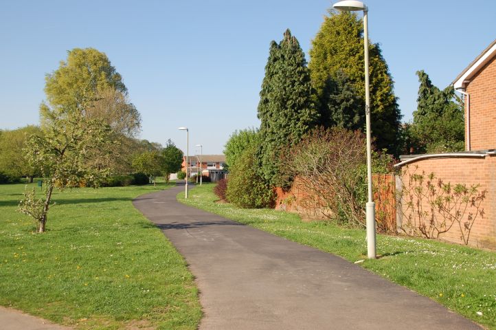
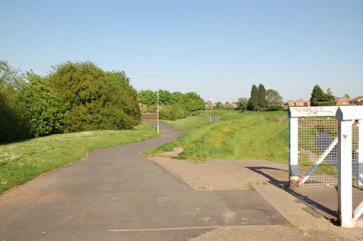
After a short section on
road, the cycle path from Burleigh College is picked up in Cothelstone
Ave, which follows the boundary between a large green space and the ends
of a number of short cul-de-sacs.
©2008 Stephen Dee
ID 2008-05-08-27288 |
 |
|
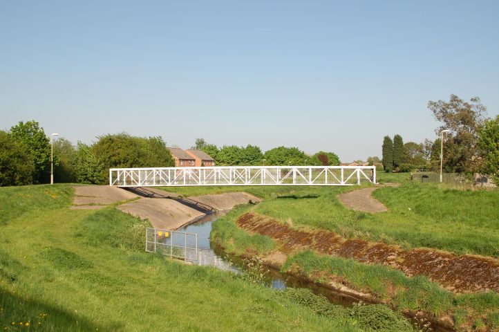
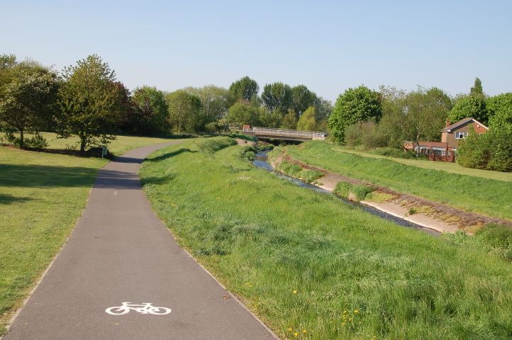
The cycle path from Burleigh
College crosses the Black Brook on the white bridge. The brook has
classic flood defence measures of high levees on either side with a
central narrow channel for normal flow. I have never seen the
level raise much above "normal" levels. Friends who live
near the Black Brook have seen the brook flood in the past.
©2008 Stephen Dee
ID 2008-05-08-27283 |
 |
|
After crossing the Black
Brook, I follow Blackbrook Way which runs west - east along the Black
Brook, just below the levee on the north bank.
©2008 Stephen Dee
ID 2008-05-08-27284 |
 |
|
Blackbrook Way crosses three
roads on the level and also has a number of sharp blind bends, one of
which is as it crosses the bridge above, which crosses one the of the
tributary flood/drainage channels on the north side of the Black Brook.
©2008 Stephen Dee
ID 2008-05-08-27278 |
 |
|
This is where Blackbrook Way
crosses Braddon Road. The view illustrates the nice green avenue
that Black Brook Way follows.
©2008 Stephen Dee
ID 2008-05-08-27277 |
 |
|
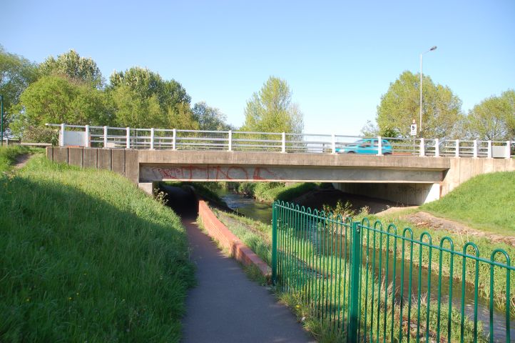
The view from where Blackbrook Way crosses Barsby Road. The bridge at the end conveys the
A6.
©2008 Stephen Dee
ID 2008-05-08-27275 |
 |
|
As Blackbrook Way dives
under the A6, the path narrows and there is a low height which is just
high enough not to hit ones head. The local council clearly had too
much spare money in 2007/2008 as along parts of Blackbrook Way green
fencing has appeared to prevent people accidently falling into the
brook. At the other side of the bridge the path turns 90 degrees
in a blind turn.
©2008 Stephen Dee
ID 2008-05-08-27273 |
 |
|
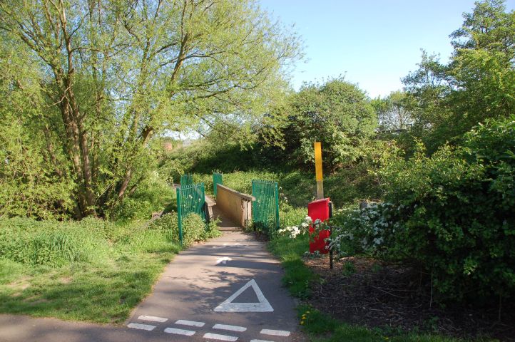
After a short section
parallel and below the A6, the Blackbrook Way crosses a drain/flood
channel and meets up with the road access to the back end of Derby Road
Playing Fields. Note the green new fencing - the money would of
been better spent on the making the bridge wider. I am not sure if
a baby trailer could be taken across the bridge.
©2008 Stephen Dee
ID 2008-05-08-27270 |