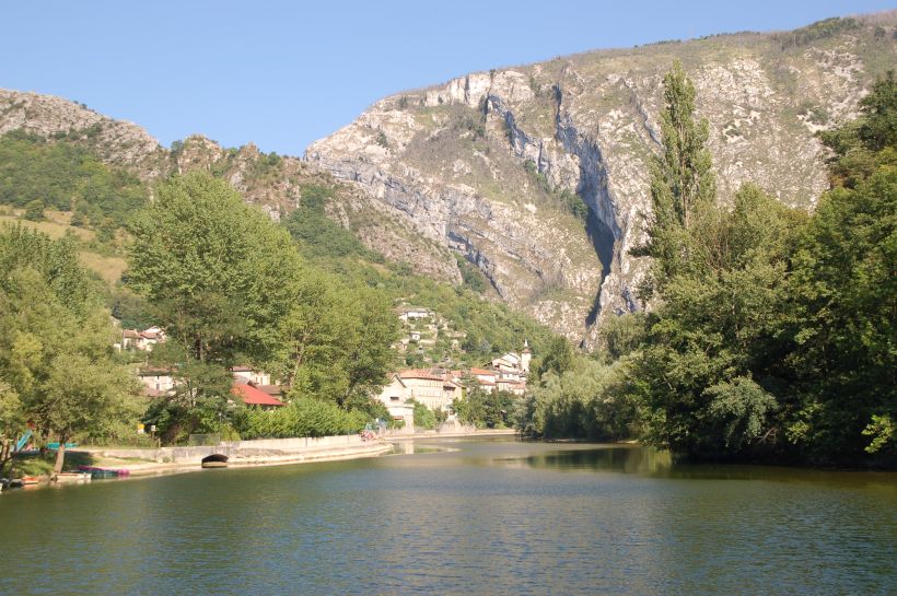
Our ride started at the Camping Muncipal Pont-en-Royans. Where we were camping was about 200m above sea level. The dramatic rise of the Vercors from the Isère valley is demonstrated by this view not far from the campsite, the top of the hill in the background is about 800m, ie an almost 600m sheer drop!. The river is the la Bourne a tributary of the Isère. The river la Bourne enters a gorge in the gap in the limestone cliffs mid picture.
©Stephen Dee
ID 2007-07-31-22169
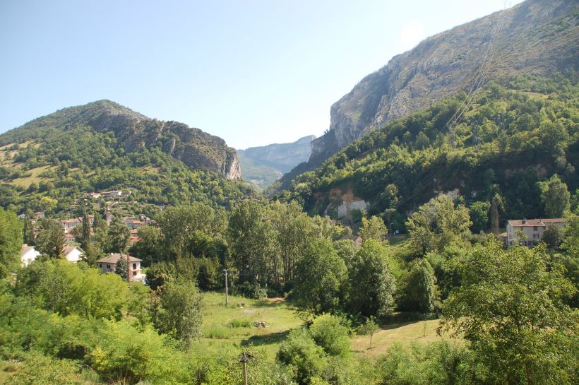
We rode through Pont-en-Royans and headed towards Ste-Eulalie-en-Royans on the D54. This is the view as we looked back towards Pont-en-Royans and the entrance to the Gorge in which the river la Bourne flows through.
©Stephen Dee
ID 2007-08-01-22207
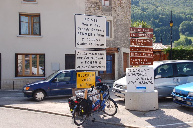
Our plan was to ride through the Route des Grands Goulets, which is a classic limestone gorge and then head to Villard-de-Lans. However when we got into Ste-Eulalie-en-Royans we found that the route was closed. Talking to locals we gather that one of the tunnels in the Grand Goulets had collapsed. Later trips in the area we see that there was a major tunnelling project underway to reopen the route. Looking at the new tunnel being built at its northern end, the Grand Goulet will loose its charms.
©Stephen Dee
ID 2007-08-01-22214
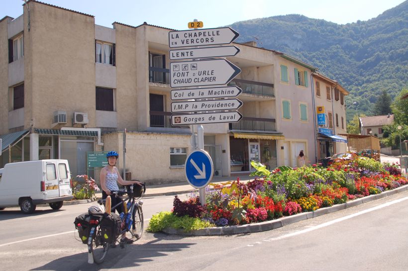
Having found the Grand Goulets closed, we headed to St-Laurent-en-Royans to pick up the D2 and the climb to Col de la Machine.
©Stephen Dee
ID 2007-08-01-22220
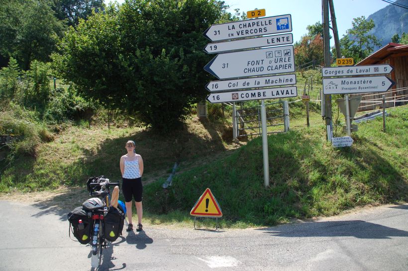
We had climbed continuously on gentle gradients for 5 miles from Pont-en-Royans before the gradients started to get steeper, at the junction of the D2 and D239. The D239 headed into the bottom of Combe Laval and the D2 was going to the top. From this point it was 10 miles to Col de la Machine - we walked about half.
©Stephen Dee
ID 2007-08-01-22228
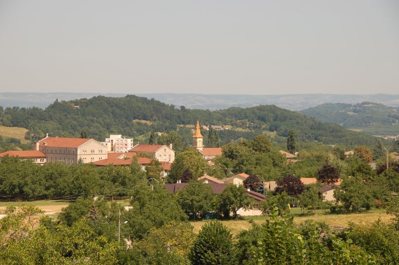
Looking back to St-Laurent-en-Royans from the lower slopes of the climb.
©Stephen Dee
ID 2007-08-01-22230
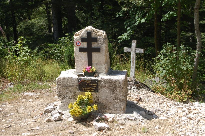
The Vercors was a stronghold of the French Resistance during the Second World War. Hence we came across many roadside graves and memorials in the Vercors such as this one on the D2
©Stephen Dee
ID 2007-08-01-22248
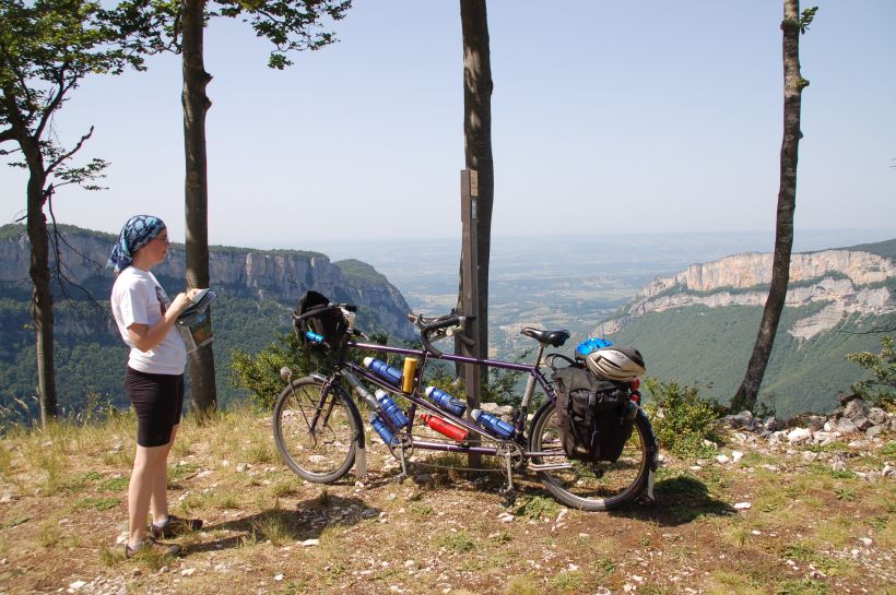
The view from near the summit of the D2, which was higher, 1090m, then the Col de la Machine. The Isère valley in the background is about 150 to 200m high.
©Stephen Dee
ID 2007-08-01-22249
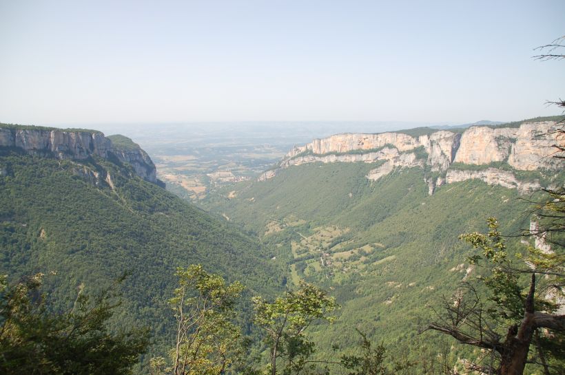
The view from near the summit of the D2, which was higher, 1090m, then the Col de la Machine. We had climbed 890m in about 22 Km ie average climb about 4%, however the main parts of the climb the gradient was about 9 to 10%.
©Stephen Dee
ID 2007-08-01-22250
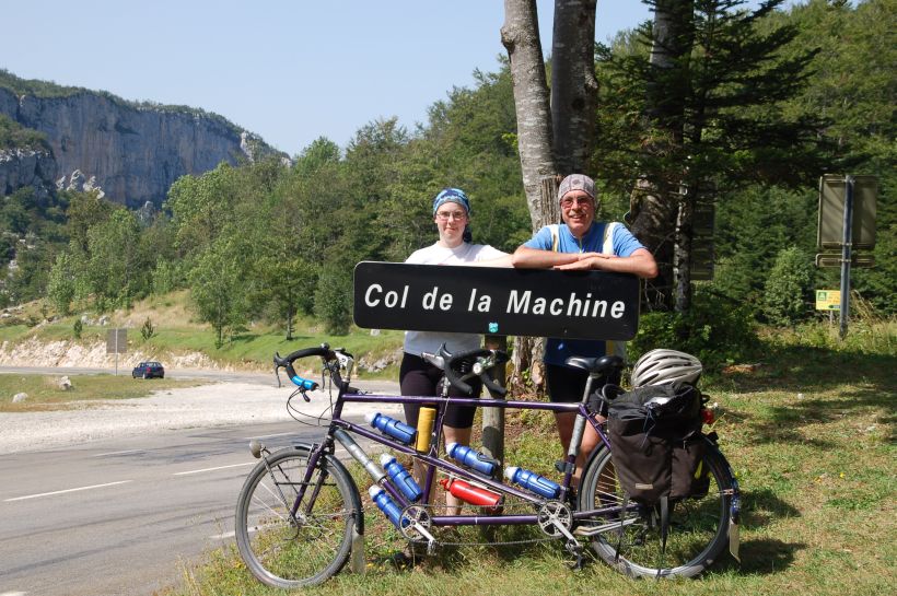
Proof we made it! The actual Col is given as 1025m. There is a sign a short way down towards Combe Lavel by a bar which gives the height as 1015m. This sign is slightly above the col on the D76 as it climbs north, at the picnic area. Our plan had been to head north along the D76 and head towards Villard-de-Lans. However we did not get to Col de la Machine until 4pm, we had started out from St-Laurent-en-Royans at midday.
©Stephen Dee
ID 2007-08-01-22268
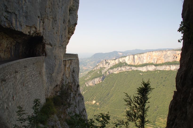
Due to our slow climb up, we decided to cut the ride short by heading down the D76 through Combe Lavel. The descent is not for the faint hearted! We were riding "drop side" of the road and the barriers were very low and the road narrow. We walked 2km of the top part of the road due to common sense and fear!
©Stephen Dee
ID 2007-08-01-22285
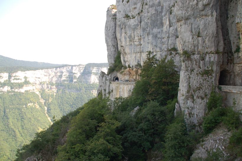
We were riding "drop side" of the road and the barriers were very low and the road narrow. We walked 2km of the top part of the road due to common sense and fear!
©Stephen Dee
ID 2007-08-01-22286
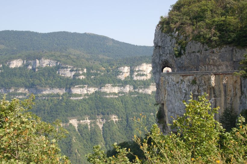
The descent is not for the faint hearted! We were riding "drop side" of the road and the barriers were very low and the road narrow. We walked 2km of the top part of the road due to common sense and fear! You see from this view looking back why we walk this part of the descent! A tumble over the edge is curtains!
©Stephen Dee
ID 2007-08-01-22289
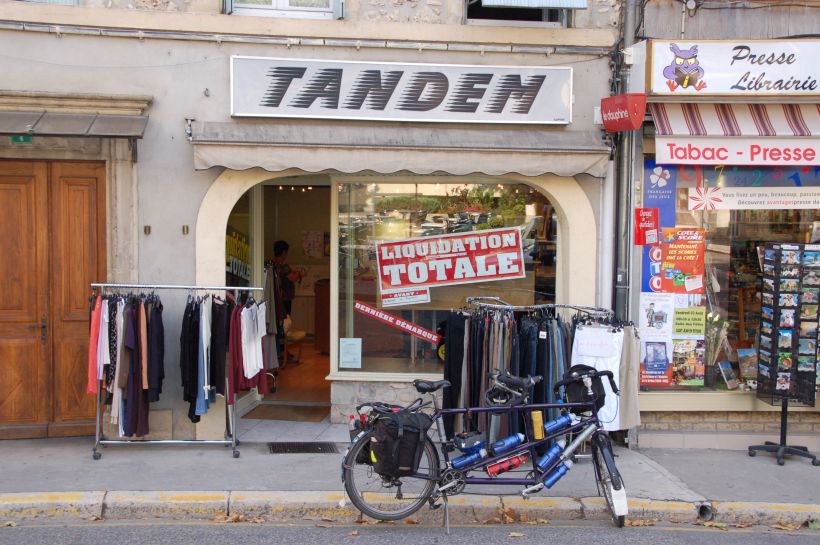
The D76 took us into St-Jean-en-Royans, where we had a ice cream stop and found a "Tandem" shop.
©Stephen Dee
ID 2007-08-01-22291
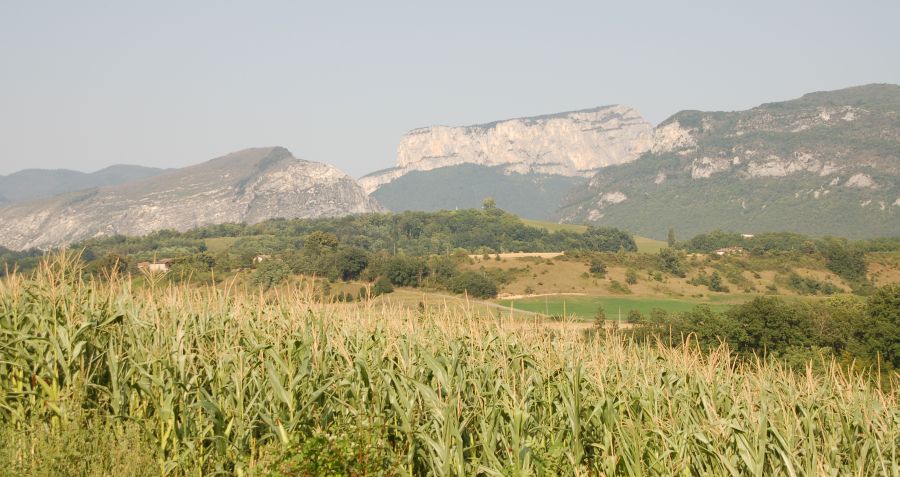
From St-Jean-en-Royans we continued along the D76 and then cut across to the D531 and rode back along la Bourne through Auberives-en-Royans, where we were able to get nice views looking back at the limestone massif of the Vercors.
©Stephen Dee
ID 2007-08-01-22296