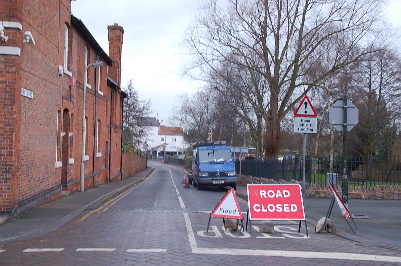
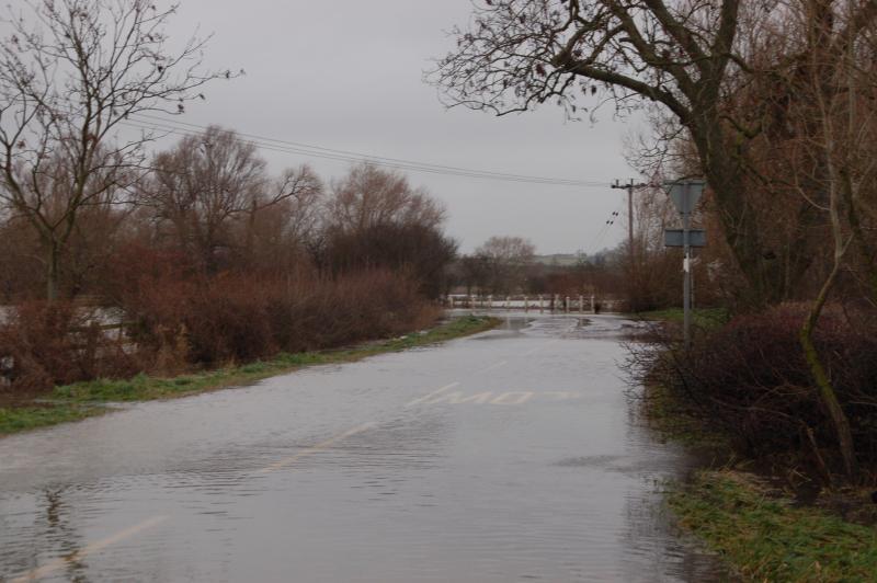
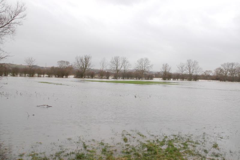
With a very wet autumn the ground is waterlogged so any rain is quickly flowing off the land and heading for the rivers, around Shepshed, the waters flow into the River Soar. I had attempted to ride Slash Lane in flood at the beginning of December last year but I chickened out! With reports of the more floods I had permission from Senior Management to ride home that way - that was in the dark and the floods were knee high. So I took advantage of a 10am start at work to ride a long way to work to see the floods in daylight the following morning. This is the start of Sileby Road in Mountsorrel, which links Mountsorrel with the A6, Sileby and Barrow upon Soar (via Slash Lane)
©Stephen Dee
ID 2007-01-12-17064
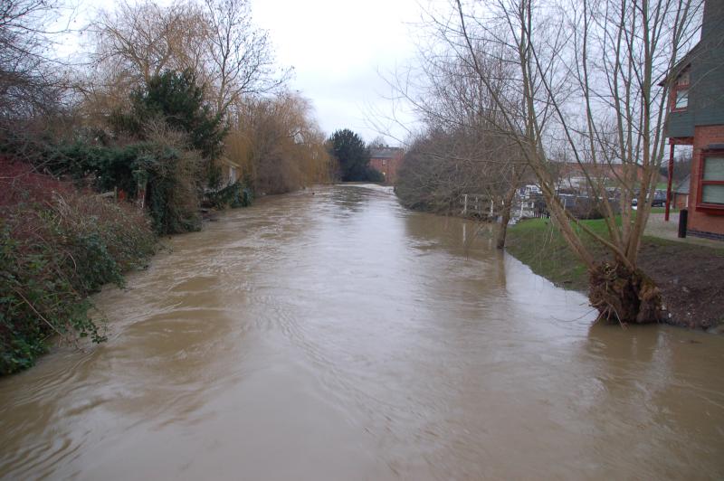
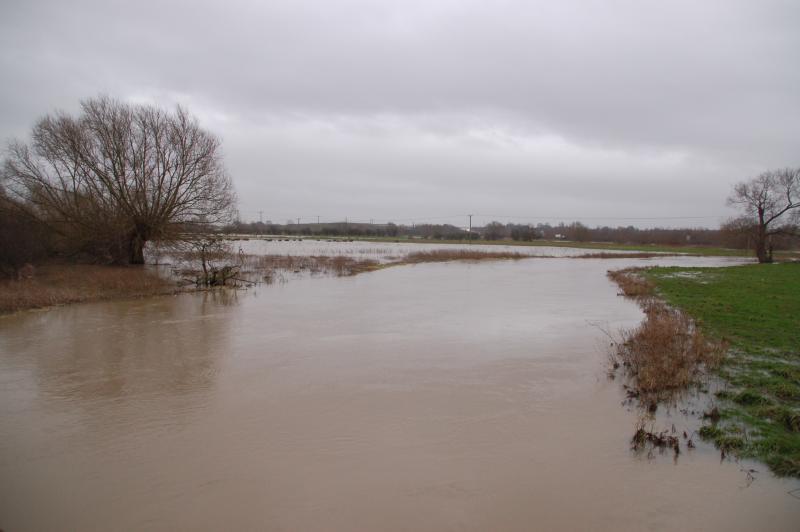
The River Soar flows south to north and can be considered a "senile river" with a wide flood plain in the Soar Valley area around the villages of Barrow upon Soar, Quorn, Sileby, Mountsorrel and the town of Loughborough, up to where it joins the River Trent at Redhill. This is the first and most westerly of the channels of the the River Soar that are crossed by Sileby Road. This view is looking north down stream.
©Stephen Dee
ID 2007-01-12-17065
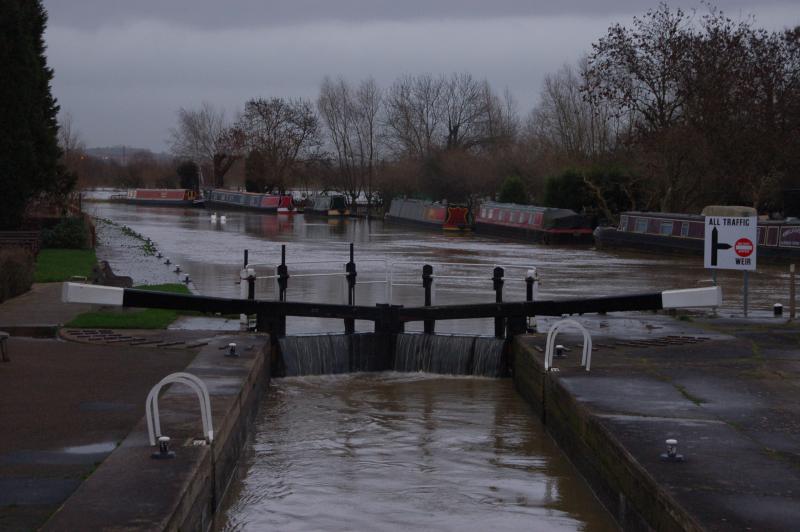
The River Soar is "canalised" with a number of navigation channels and locks. The river was flowing over the top of the lock gates at Mountsorrel. This view is looking south from the canal bridge.
©Stephen Dee
ID 2007-01-12-17068
This view is looking north from the canal bridge.
©Stephen Dee
ID 2007-01-12-17070
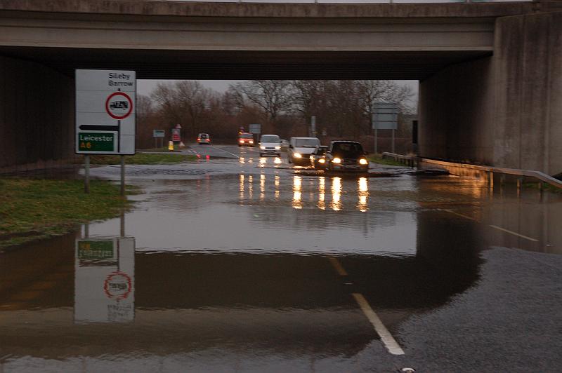
View looking east under the A6 road. This part of the road is the first section that was flooded..
©Stephen Dee
ID 2007-01-12-17072
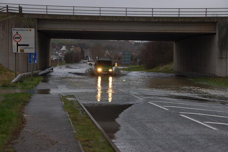
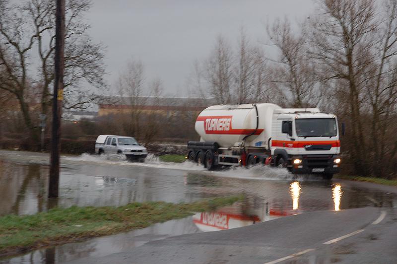
View looking west under the A6 road. Larger vehicles such as vans could get through with ease. The few cars etc which had got through this flood chickened out when they saw the floods further on.
©Stephen Dee
ID 2007-01-12-17076
View looking east along Sileby Road from the bend just after the A6 looking towards the bridge (dry section of road) across the main channel of the River Soar.
©Stephen Dee
ID 2007-01-12-17095
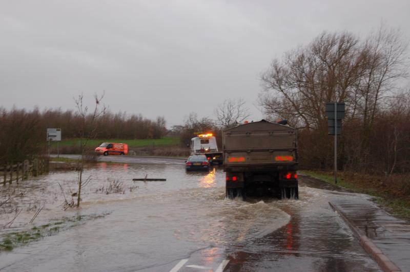
View looking west along Sileby Road from the bend just after the A6 looking back to the A6. The car was being rescued by the RAC after coming to grief in the floods. A lot of drivers and one cyclist (yours truly) had ignored the road closure notices.
©Stephen Dee
ID 2007-01-12-17096
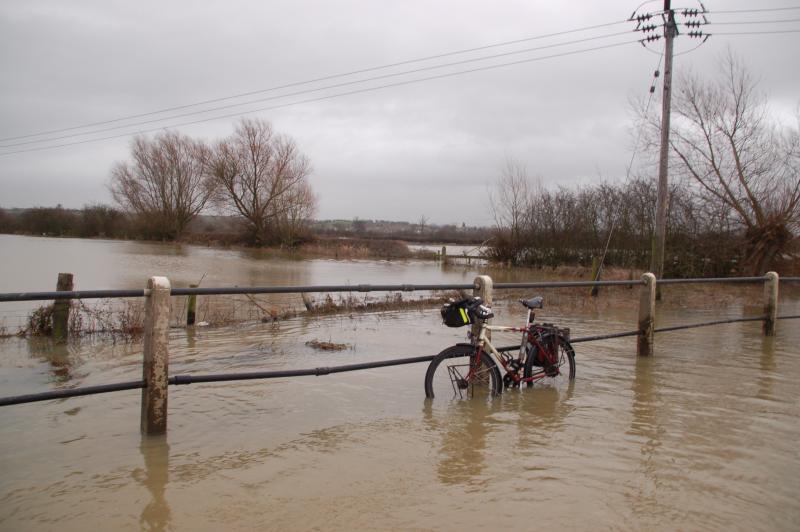
View looking south from the bridge across the main channel of the River Soar on Sileby Road.
©Stephen Dee
ID 2007-01-12-17098
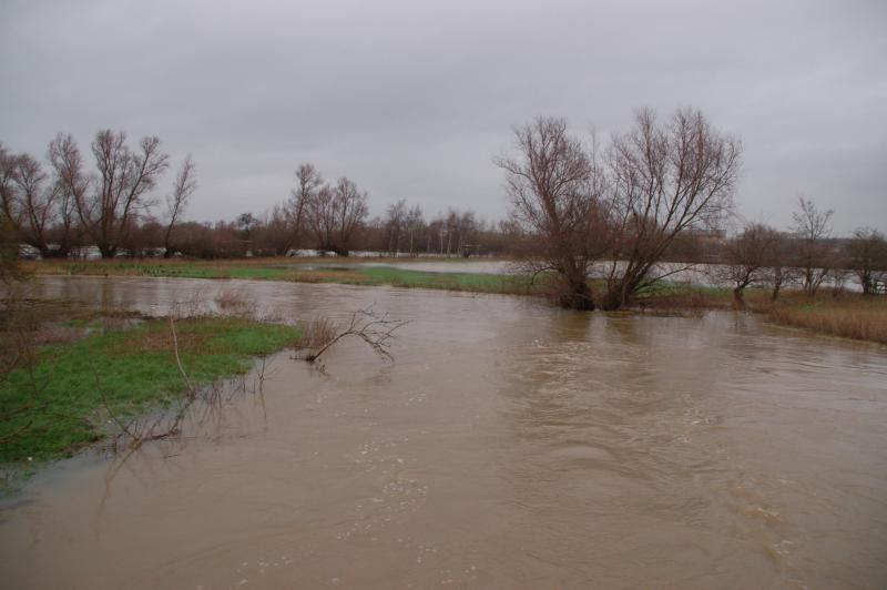
View looking north from the bridge across the main channel of the River Soar on Sileby Road.
©Stephen Dee
ID 2007-01-12-17099
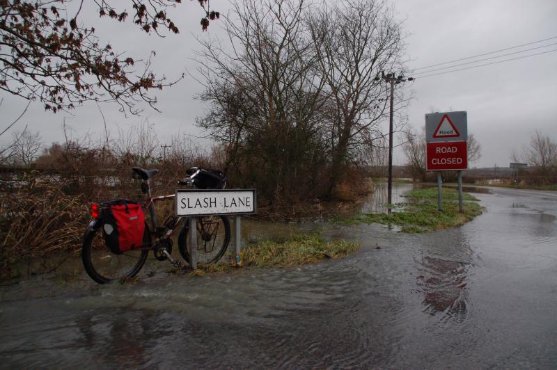
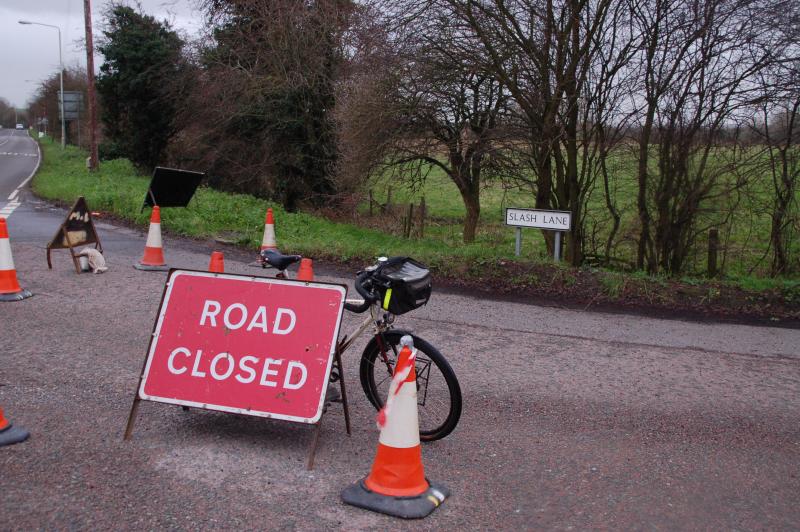
Junction of Slash Lane with Sileby Road.
©Stephen Dee
ID 2007-01-12-17102
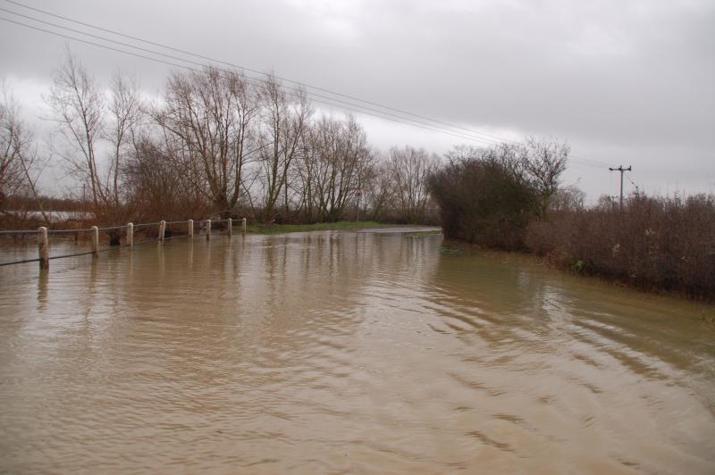
Slash Lane approaching its junction with Sileby Lane. The floods were worst then Sileby Road and again was only passable by large vehicles as above or cyclists who didn't mind getting their feet wet. Slash Lane can be flooded with no flooding in Sileby Road.
©Stephen Dee
ID 2007-01-12-17104
Slash Lane approaching its junction with Sileby Road. In floods the best thing to do is follow the road centre line as that is the shallowest part normally. That advice is fine if there are centre line markings, and the they can be seen as above.
©Stephen Dee
ID 2007-01-12-17108
This section of Slash Lane with the railings is the first section that gets flooded and hence it can be flooded when all other rpads remain dry. Many years ago when Ann and I where out on the tandem we ferried a couple of walkers across the flooded section using the tandem!
©Stephen Dee
ID 2007-01-12-17108
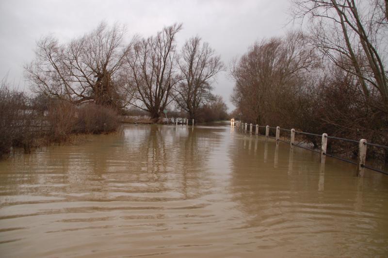
Looking south towards Sileby Road along Slash Lane. When the waters are deeper and muddy like this trying to work out where the road goes, let alone any road markings is a problem and the safest thing can be get off and walk.
©Stephen Dee
ID 2007-01-12-17111
Looking north towards Barrow upon Soar along Slash Lane. When the waters are deep and muddy like this trying to work out where the road goes, let alone any road markings is a problem and the safest thing can be get of and walk. In this view the tarmac surface is only about half of the distance across the photo.
©Stephen Dee
ID 2007-01-12-17112
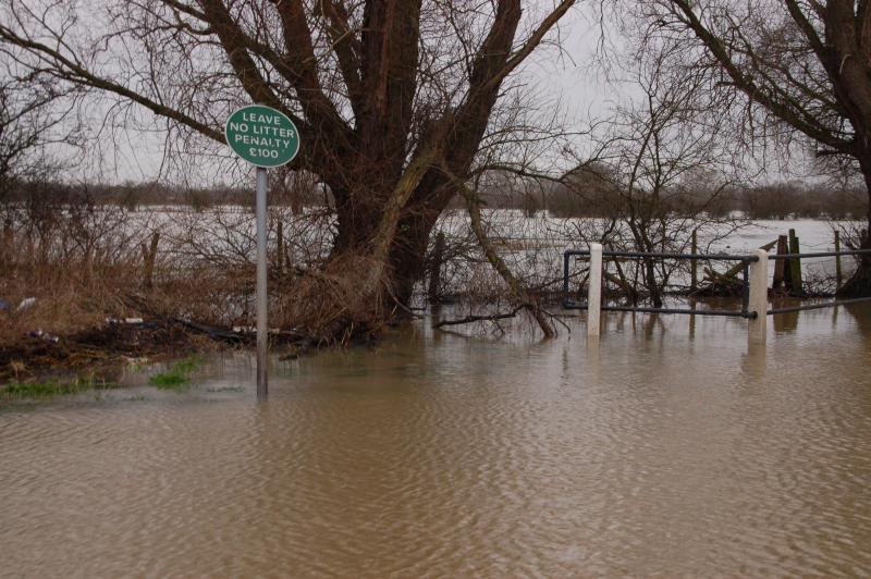
Any litter that gets left soon gets floated away in these conditions.
©Stephen Dee
ID 2007-01-12-17113
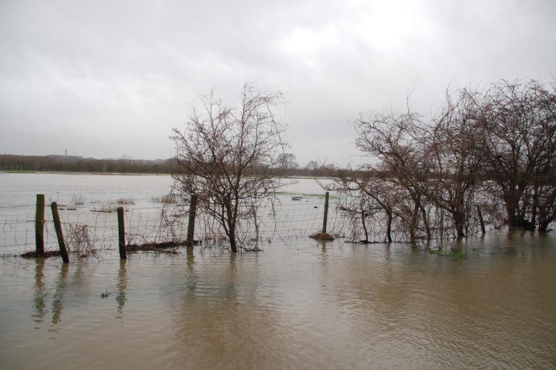
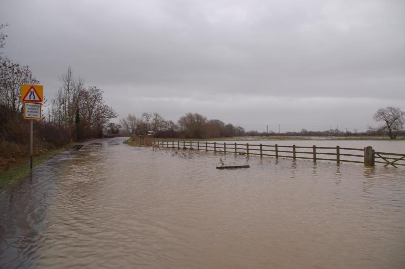
View looking across the road boundary across fields.
©Stephen Dee
ID 2007-01-12-17116
Looking south towards Sileby Road along Slash Lane.
©Stephen Dee
ID 2007-01-12-17117
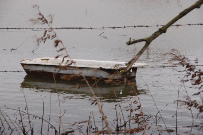
An old bath that had been dumped by a tree in Slash Lane has become a boat in a sea of water.
©Stephen Dee
ID 2007-01-12-17124
View looking across the road boundary across fields.
©Stephen Dee
ID 2007-01-12-17129
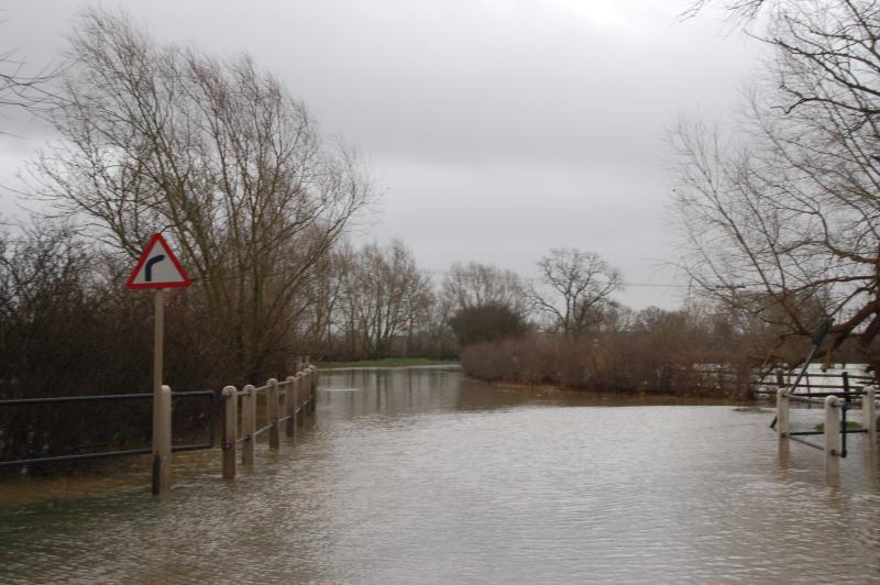
The Barrow upon Soar end of Slash Lane.
©Stephen Dee
ID 2007-01-12-17136
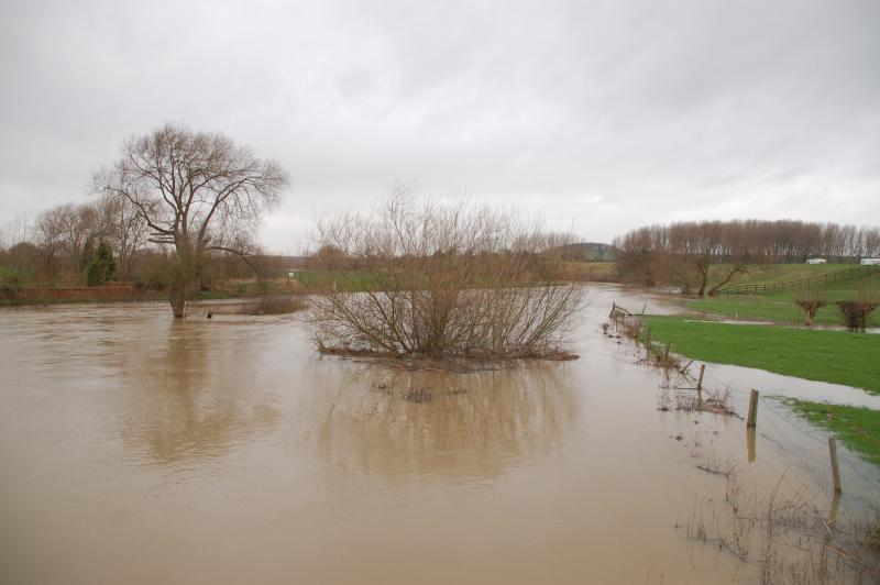
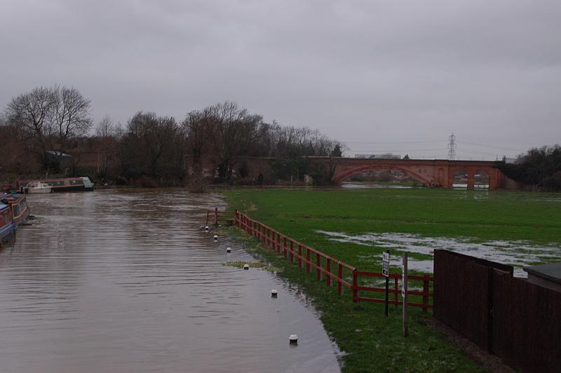
Having done a DeeTour and crossed the River Soar, to get to work in Loughborough I had to re-cross it. This I did on the A60 at Cotes Mill, just to the east of Loughborough. Here is a view of the River Soar where it has bursts it banks, looking north.
©Stephen Dee
ID 2007-01-12-17137