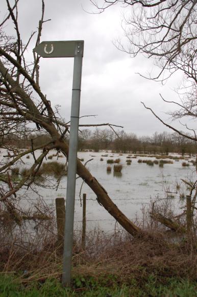
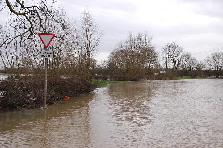
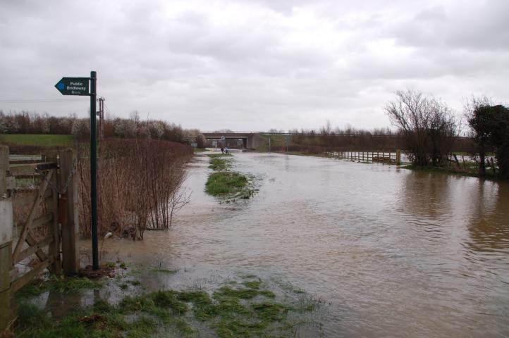
Bridleway I30 offers a very wet route across the flood plain from Slash Lane to Silbey Road in Mountsorrel. This is the start in Slash Lane, Barrow upon Soar..
©Stephen Dee
ID 2007-03-05-17730
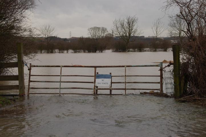
Entrance to a field off Slash Lane - The notice refers to the fishing rights along the R Soar, the bank of which is beyond the trees in the distance.
©Stephen Dee
ID 2007-03-05-17734
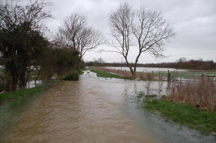
View from the middle of Slash Lane looking north west, the bank of the R Soar is beyond the tree line in the distance.
©Stephen Dee
ID 2007-03-05-17750
Slash Lane looking south towards Sileby Road.
©Stephen Dee
ID 2007-03-05-17746
Slash Lane looking south towards its junction with Sileby Road.
©Stephen Dee
ID 2007-03-05-17758
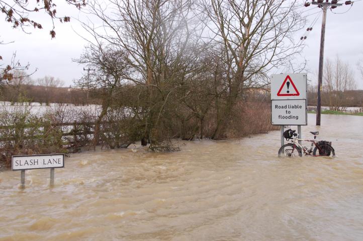
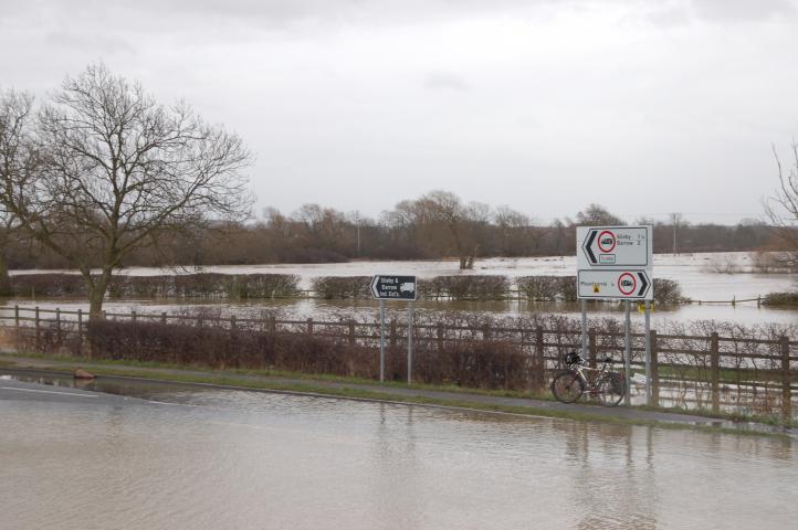
Slash Lane at its junction with Sileby Road. The sign is a bit of an understatement! My bike is standing on an elevated part of the road, the hubs are just above the water level. I had to carry my bike for much of Slash Lane and Sileby Road as the water was up above my knees!
©Stephen Dee
ID 2007-03-05-17760
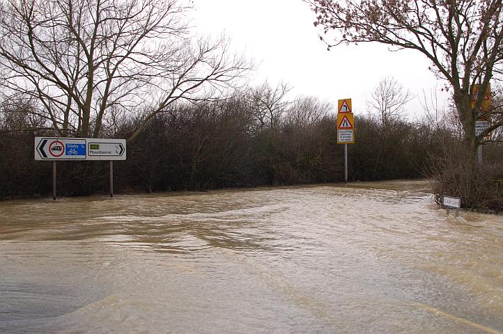
Slash Lane at its junction with Sileby Road. The waves were due to the flow of the water coming off the fields and across the road.
©Stephen Dee
ID 2007-03-05-17764
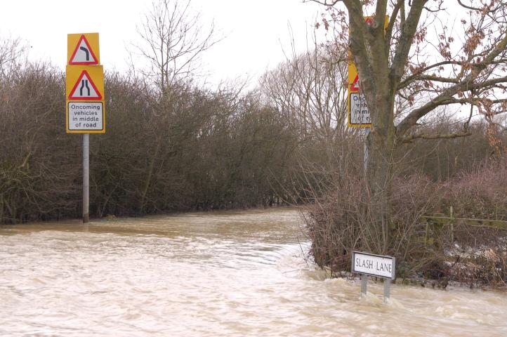
Slash Lane at its junction with Sileby Road. The waves were due to the flow of the water coming off the fields and across the road.
©Stephen Dee
ID 2007-03-05-17765
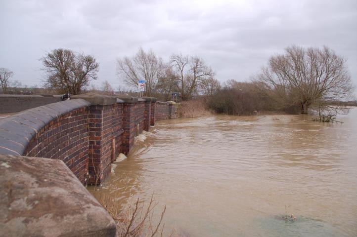
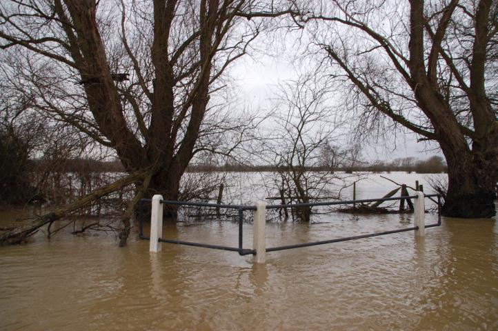
The south, up stream side of the bridge across the main channel of the R Soar. The bridge is almost acting as a dam.
©Stephen Dee
ID 2007-03-05-17772
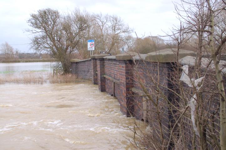
The north, down stream side of the bridge across the main channel of the R Soar.
©Stephen Dee
ID 2007-03-05-17776
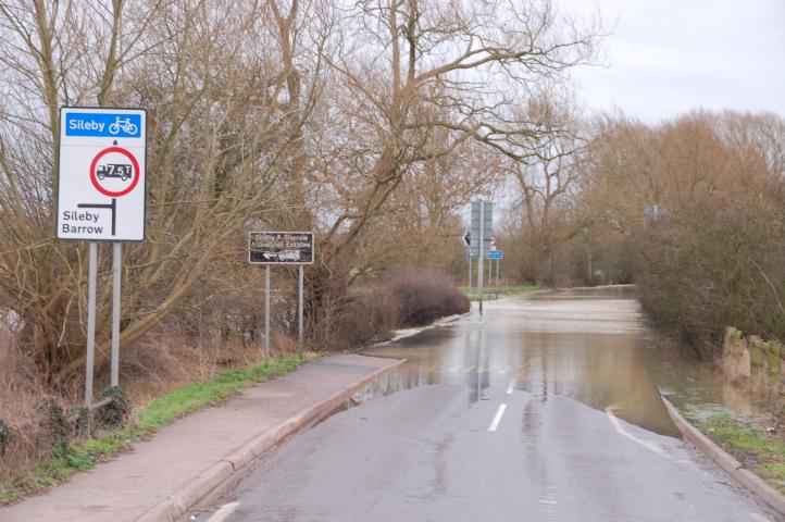
The road across the bridge was the only dry part of the road. looking towards Slash Lane.
©Stephen Dee
ID 2007-03-05-17778
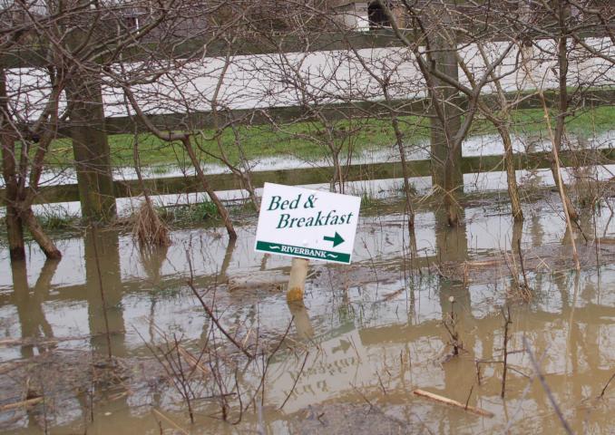
A sign advertising a local B&B at the road side opposite the junction of Sileby Road and the A6.
©Stephen Dee
ID 2007-03-05-17787
Sileby Road at its junction with the A6, southbound looking south across the fields.
©Stephen Dee
ID 2007-03-05-17792
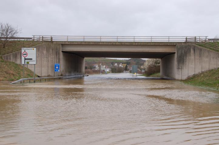
Looking west along Sileby Road, under the A6.
©Stephen Dee
ID 2007-03-05-17796
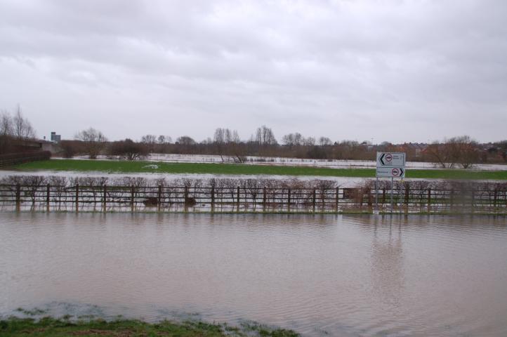
Sileby Road at its junction with the A6, northbound looking south across the fields.
©Stephen Dee
ID 2007-03-05-17802
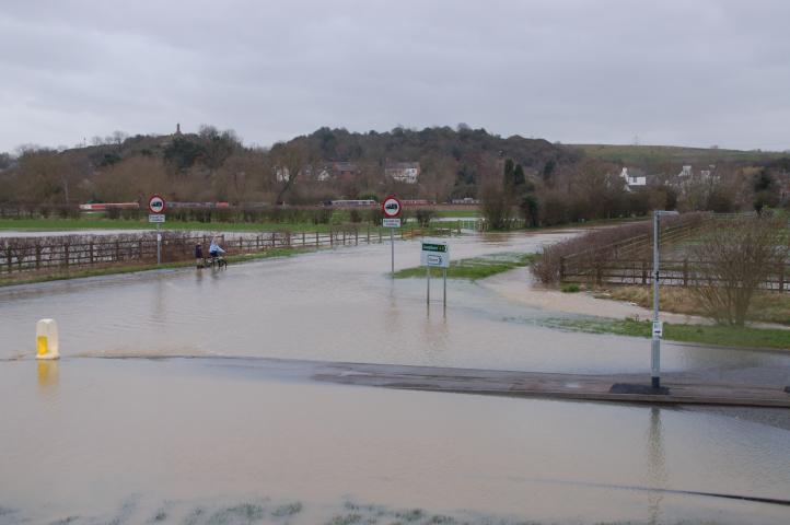
Sileby Road at its junction with the A6, northbound looking west towards Mountsorrel.
©Stephen Dee
ID 2007-03-05-17804
Sileby Road at its junction with bridleway I30 looking east towards the A6.
©Stephen Dee
ID 2007-03-05-17813
Looking along bridleway I30 from Sileby Road.
©Stephen Dee
ID 2007-03-05-17812
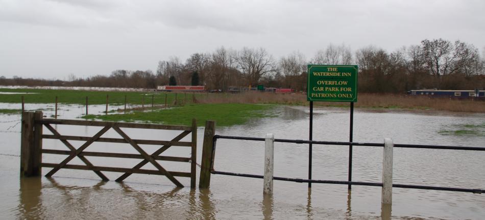
The overflow car park for the Waterside Inn at Mountsorrel - overflow for boats?
©Stephen Dee
ID 2007-03-05-17817
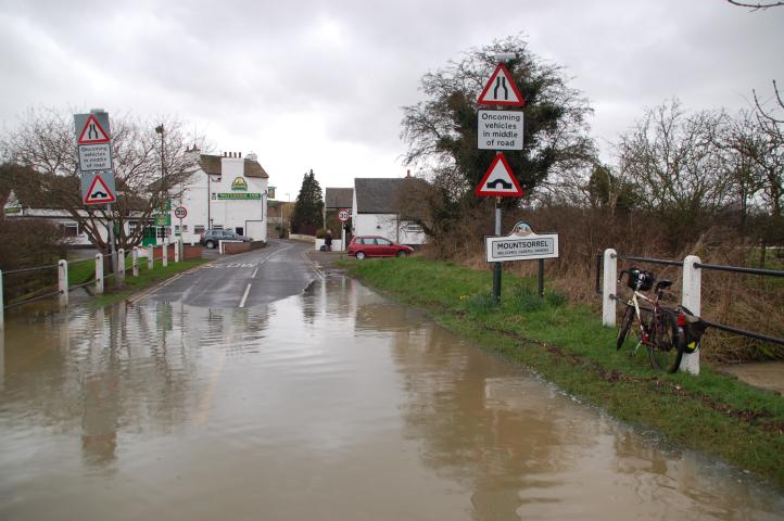
Coming from Mountsorrel the flood in Sileby Road started just east of the Waterside inn.
©Stephen Dee
ID 2007-03-05-17821
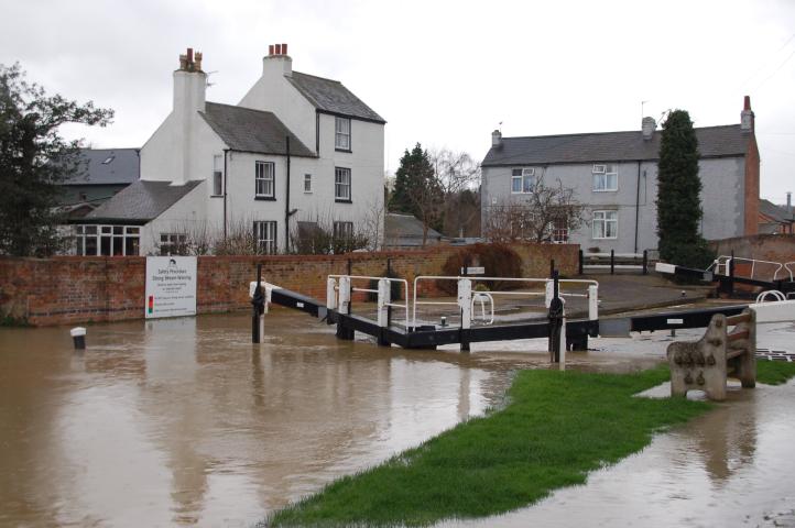
Water flowing over the lock of the canalised section of the river.
©Stephen Dee
ID 2007-03-05-17826
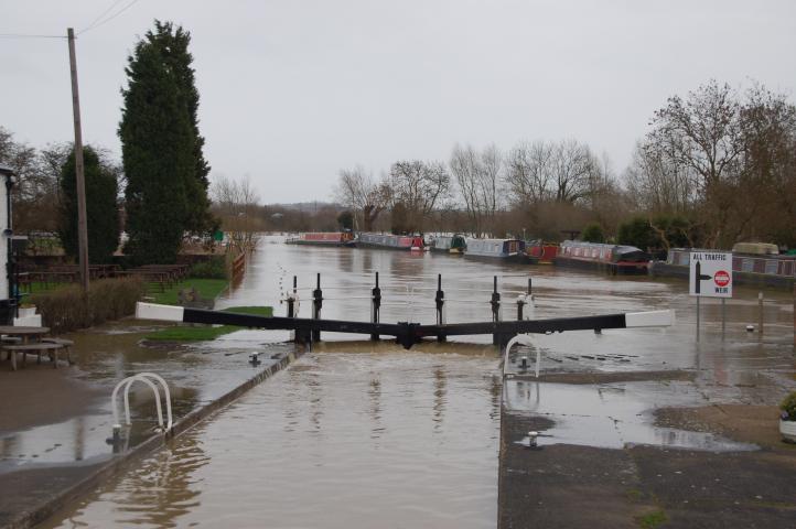
Water flowing over the lock of the canalised section of the river.
©Stephen Dee
ID 2007-03-05-17831
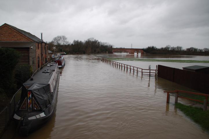
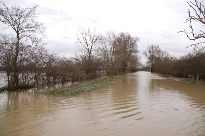
Looking north from the canal bridge, the river has spread across the surrounding fields and almost covered them completely.
©Stephen Dee
ID 2007-03-05-17829
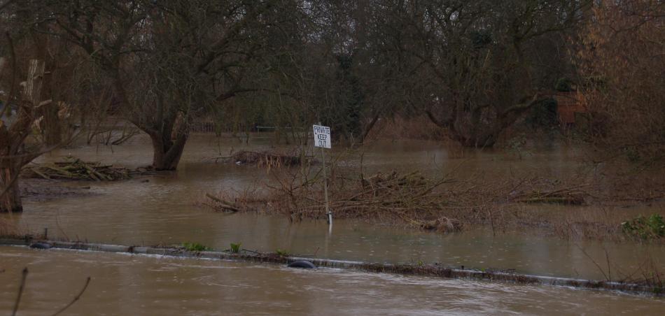
A sign that looks out of place on what was the canal bank!
©Stephen Dee
ID 2007-03-05-17837